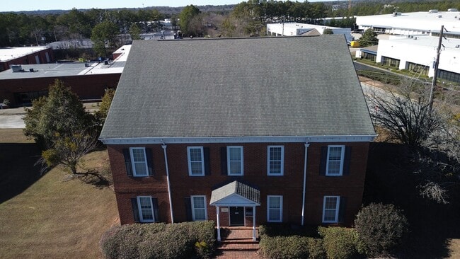
Property Record
7171 Jonesboro Rd, Morrow, GA 30260
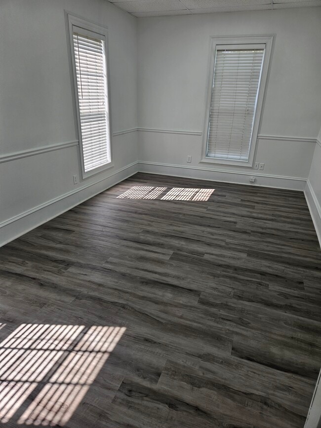
Current Lease Availabilities
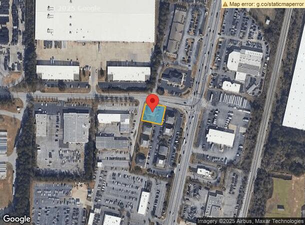
NEARBY LISTINGS FOR SALE OR LEASE
Property Detail
7171 Jonesboro Rd
12-0081C-00A-010
7171 Joncsboro Realty Group L
Officebuilding
Clayton
X
Georgia
13063C0086F
81
2024
0.32 AC
2024
North Clayton/Airport
040417
Atlanta
2,601 SF
Atlanta-Sandy Springs-Roswell, GA
DEMOGRAPHICS near 7171 Jonesboro Rd
1 Mile
3 Mile
5 Mile
2024 Total Population
6,420
77,332
195,222
2029 Population
6,474
77,174
194,513
Pop Growth 2024-2029
+ 0.84%
(0.20%)
(0.36%)
Average Age
34
35
36
2024 Total Households
2,974
27,836
70,169
HH Growth 2024-2029
+ 1.01%
(0.06%)
(0.30%)
Median Household Inc
$56,659
$47,513
$49,419
Avg Household Size
2.10
2.70
2.70
2024 Avg HH Vehicles
1.00
2.00
2.00
Median Home Value
$197,109
$151,777
$166,877
Median Year Built
1996
1980
1984
Nearby Places
- Restaurants
- Banks
- Shops
- Fitness
- Groceries
PUBLIC TRANSPORTATION
AIRPORT
Hartsfield - Jackson Atlanta International
DRIVE
WALK
Distance
Hartsfield - Jackson Atlanta International
16 min
10.0 mi
Freight Ports
Georgia Ports - Savannah
DRIVE
WALK
Distance
Georgia Ports - Savannah
263 min
235.4 mi
Nearby Properties
Address
Land Use
TOTAL SIZE
Lot Size
Zoning
Address
Land Use
TOTAL SIZE
Lot Size
Zoning
518,648 SF
58.27 AC
MCD
Address
Land Use
TOTAL SIZE
Lot Size
Zoning
324 SF
49.49 AC
RM
Address
Land Use
TOTAL SIZE
Lot Size
Zoning
250 SF
31.25 AC
RM
Address
Land Use
TOTAL SIZE
Lot Size
Zoning
330 SF
33.30 AC
RM
Address
Land Use
TOTAL SIZE
Lot Size
Zoning
230 SF
27.09 AC
RM
Address
Land Use
TOTAL SIZE
Lot Size
Zoning
216 SF
31.17 AC
RM
Address
Land Use
TOTAL SIZE
Lot Size
Zoning
217,289 SF
52.12 AC
OI
Address
Land Use
TOTAL SIZE
Lot Size
Zoning
198 SF
32.10 AC
RM
Address
Land Use
TOTAL SIZE
Lot Size
Zoning
200 SF
23.02 AC
RM
Address
Land Use
TOTAL SIZE
Lot Size
Zoning
200 SF
20.23 AC
RM
Address
Land Use
TOTAL SIZE
Lot Size
Zoning
194,682 SF
27.80 AC
OI
Address
Land Use
TOTAL SIZE
Lot Size
Zoning
190 SF
21.66 AC
RM
Address
Land Use
TOTAL SIZE
Lot Size
Zoning
252 SF
23.62 AC
RM
Address
Land Use
TOTAL SIZE
Lot Size
Zoning
260 SF
33.31 AC
MXR
Address
Land Use
TOTAL SIZE
Lot Size
Zoning
707,780 SF
85.14 AC
MXI
Address
Land Use
TOTAL SIZE
Lot Size
Zoning
264 SF
25.80 AC
RM
Address
Land Use
TOTAL SIZE
Lot Size
Zoning
200,370 SF
23.81 AC
C
Address
Land Use
TOTAL SIZE
Lot Size
Zoning
123,000 SF
48 AC
RS110
Address
Land Use
TOTAL SIZE
Lot Size
Zoning
168 SF
32.25 AC
RM
Address
Land Use
TOTAL SIZE
Lot Size
Zoning
176 SF
24.93 AC
RM
Address
Land Use
TOTAL SIZE
Lot Size
Zoning
218 SF
17.30 AC
RM
Address
Land Use
TOTAL SIZE
Lot Size
Zoning
220 SF
26.84 AC
RM
Address
Land Use
TOTAL SIZE
Lot Size
Zoning
87,449 SF
14 AC
MC
Address
Land Use
TOTAL SIZE
Lot Size
Zoning
191 SF
17.70 AC
RM
Address
Land Use
TOTAL SIZE
Lot Size
Zoning
346 SF
34.53 AC
RM
Address
Land Use
TOTAL SIZE
Lot Size
Zoning
123,842 SF
31.53 AC
RS110
Address
Land Use
TOTAL SIZE
Lot Size
Zoning
200 SF
18.36 AC
RM
Address
Land Use
TOTAL SIZE
Lot Size
Zoning
1,140 SF
187.84 AC
MX
Address
Land Use
TOTAL SIZE
Lot Size
Zoning
410 SF
35 AC
RM
Address
Land Use
TOTAL SIZE
Lot Size
Zoning
105,260 SF
12.67 AC
C
The World's #1 Commercial Real Estate Marketplace
Connect with us
© 2025 CoStar Group
The information above has been obtained from sources believed reliable. While we do not doubt its accuracy we have not verified it and make no guarantee, warranty or representation about it. It is your responsibility to independently confirm its accuracy and completeness. Any projections, opinions, assumptions, or estimates used are for example only and do not represent the current or future performance of the property. The value of this transaction to you depends on tax and other factors which should be evaluated by your tax, financial, and legal advisors. You and your advisors should conduct a careful, independent investigation of the property to determine to your satisfaction the suitability of the property for your needs.